Two cabbies sit outside the airport making small talk, waiting for the plane to land at Juancho E. Yrausquin Airport on Saba. One of them, Billy, starts telling me about how, for years, his dog has gone grocery shopping for her own food. All he does is hold up her empty food bag, and off she goes down the street, through the double doors and down the aisles. Once she bolts out the door, the clerk makes a note of it to be paid later. “She’s usually out and back in only a few minutes,” Billy tells me, “Except the day they rearranged the shelves. It took her a little longer that day.”
I’m not surprised. These are the types of stories I’ve gotten used to hearing during my time on the small island: dogs who grocery shop for their owners; vertical thumbs that substitute for bus routes; courtship that centers around weekly karaoke; government-run goat buyback programs that dominate headlines. It’s a far cry from Philipsburg and Gustavia Harbor, to be sure. The makeup of the island—a miniscule land mass of five square miles, most of which is undeveloped due to rocky, volcanic terrain—and a humble population of less than 2,000 certainly play a large role in shaping its society. But people have been traveling the Caribbean for centuries, and tourism has masked local culture on countless islands, including some within sight of Saba. So why has it been spared?

Will McGough
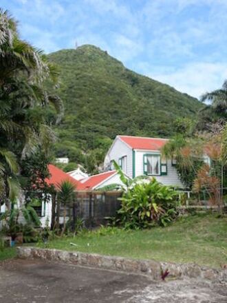
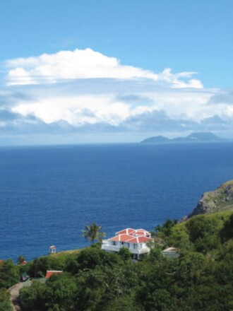
Perhaps it’s that Saba lacks a key component to conventional Caribbean travel: beaches. Think of it as the top quarter of a mountain shooting straight out of the water, its coastline a vertical cliff and hillsides covered in moist jungle terrain. Two towns, Windwardside and The Bottom (the captial of Saba), straddle the highest point on Mt. Scenery, which soars up into the clouds at 2,910 feet. Before “The Road” was built—the only major road that connects the airport and the two towns on the island, with broad views of the ocean and Saba’s impossibly steep terrain—the locals hiked between these villages on trails that traverse the rocky landscape and pass through clusters of rainforest. Today, these island-linking paths are the hub of outdoor recreation, although it’s hard to tell from how underused they’ve become since “The Road”. Many trails are now covered with grass.
On most of the island’s coast, the water surges up the base of the cliffs, leaving only a foot or two of rock-littered dry land. There’s one swimmable, man-made beach on the island, Cove Bay, made by sand brought over from St. Maarten and rocks that block the current (the locals are disappointed by the construction, claiming the water doesn’t get enough circulation).
The island’s only natural beach is at Well’s Bay, but it comes and goes with the tides, disappearing for months at a time. In photographs, Well’s Bay looks like your classic Caribbean cove with its bright blue water, soft sand, and tall cliffs that slope gently down to the sea at the far end. In theory, it’s the perfect counterpoint to the island’s mountainous terrain. But unfortunately, Well’s Bay rarely looks like it does in the photos—Saba’s ferocious current sends the ocean rushing up to meet the base of the cliffs, crashing into the rocks and erasing any hopes of sunbathing or swimming. Right now, the beach is completely washed out.
Most of the tourists you meet on the island have come for diving and snorkeling. It’s a good draw for the island, thanks to its abundance of soft coral (think sea fans and other “waving” organisms). Yet once again, there’s a caveat. Just last week, the water was too rough for the dive boat to go out, and an underwater current had reduced visibility greatly. It sounds annoying—and it was to a certain extent—but in chatting with my dive mates, I began to discover a charm in the attitude of my fellow travelers. They aren’t here because there was a deal on a flight, or because they think it’s a name that will impress their friends. Most were long-time Caribbean travelers, familiar with the surrounding islands, looking for something different, something where real life still takes place.

Will McGough
Billy looks to the sky. Each day, five flights carrying twenty passengers each arrive on Saba from St. Maarten. It’s only a 12-minute flight, but for aviation fanatics, it is one for the record books. Saba’s airport has the smallest commercial runway in the world, a 1,312-foot strip built atop a plateau along the rocky, jagged coastline. When the next incoming flight lands, I’ll have to excuse myself from Billy’s conversation—If you’re not standing beside the runway when the last passenger exits, they’re likely to load up and leave without you. But for now, I’m good. There’s no security, so all I have to do when I see the plane coming in is walk out onto the tarmac. The limiting nature of the small runway is another form of protection for the island—though things are probably going to change, Billy tells me, slowly but surely. Lights were just installed on the runway, and there’s talk of letting planes land after sunset for the first time.
“Is there trouble in paradise?” I ask. Not so much, he says. Even with a few more flights, the lack of mainstream tourism offerings—specifically waterfront resorts—will still keep the masses at bay, and allow Saba to live up to its name, “The Unspoiled Queen,” for years to come.
Billy winks at me. “I mean come on,” he says, “Who wants to visit a Caribbean island with no beaches?”
>>Next: The Caribbean Island That Was Buried by a Volcano—and Its Return


