Japan is most often associated with images of megalopolises like Tokyo and Osaka, with their neon lights, hidden bars, and crowded subways. But there’s an antidote to all that (delightful) urban chaos: Japan’s rural side is a hiker’s paradise. Beyond the well-trod trails of famous mountains such as the Japanese Alps and the country’s icon, Mount Fuji, here are six spectacular places to explore the archipelago’s wild side on foot.
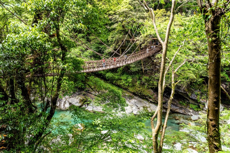
This footbridge, called a kazurabashi, is made entirely of vines and is a Japanese Tangible Folk Culture Property.
Photo by Alex_Mastro/Shutterstock
Iya Valley
Tokushima Prefecture, Shikoku
Deep in the mountains of Shikoku—the smallest of Japan’s major islands—the Iya Valley’s terraced farm plots, thatched-roof cottages, and largely uninhabited forest preserve a piece of ancient Japan. The valley was settled by 12th-century Heike samurai who, fleeing the rival Genji clan, built the region’s most popular sight: three bridges fashioned from knotted wisteria vines that could be slashed to turn the river into an impassable barrier for enemies. These bridges still hang precariously across the gorge, and you can cross them to reach the valley’s variety of hiking routes. One of the Iya Valley’s most popular hiking destinations is Mount Tsurugi, which takes roughly two hours to ascend by foot. A chairlift also takes visitors up to the summit, where a Shinto shrine, various mountain huts, and panoramic views await.
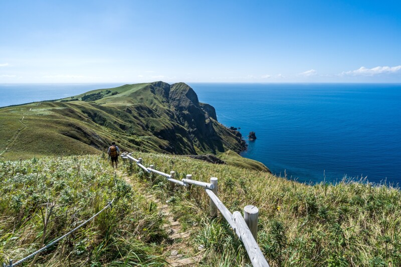
This staircase makes the 3.5-mile Momoiwa course on Rebun Island easier.
Photo by kentaro-yamazaki/Shutterstock
Rebun Island
Hokkaidō Prefecture, Hokkaidō
Located off the coast of Hokkaidō at Japan’s northernmost tip, Rebun Island has harsh winters. But during the summer months, temperatures are pleasant and exquisite alpine flowers—many of which can’t be found anywhere else—bloom. You can hike the length of the island along trail Hachijikan haikingu-kosu, which translates to “eight-hour hiking course.” This 18-mile route runs along the island’s eastern coast from the northern to the southern tips. (There is also an abbreviated four-hour course; both offer gorgeous, bloom-filled vistas.)
Shorter day hikes on Rebun Island include the 3.5-mile Momoiwa course, which skirts jagged coastlines and passes an 820-foot-tall rock shaped like a peach. The four-hour trek up Mount Rebun, the island’s highest peak, passes through fields of broadleaf bamboo and a forest of pine and birch. From the summit, you’ll have an unobstructed view of the island below and Mount Rishiri, an extinct volcano on a nearby island.
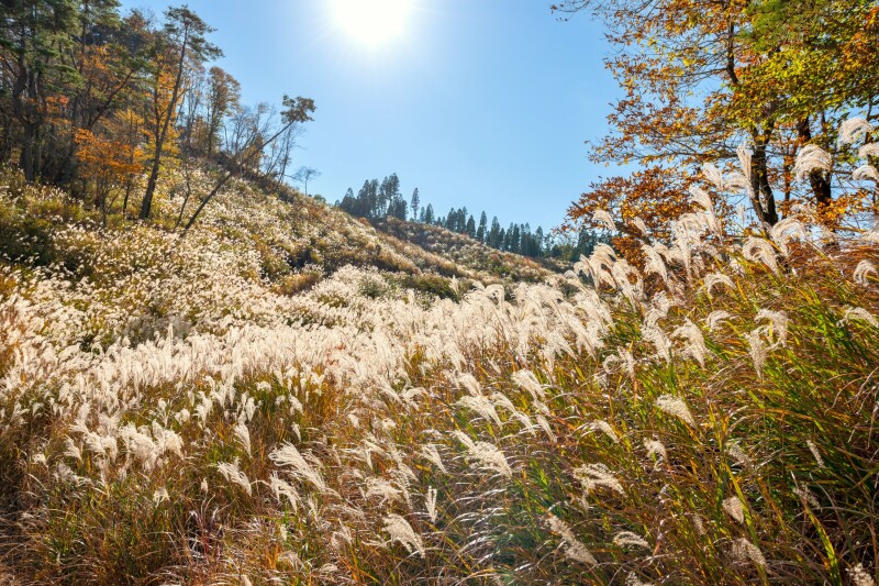
Japanese pampas grass is green in the summer and then turns a pale gold between October and November.
Photo by Trialist/Shutterstock
Tonomine Highlands
Hyōgo Prefecture, Honshu
Set atop a plateau, the Tonomine Highlands is an expanse of undulating hills covered in susuki (pampas grass), which was used as roofing thatch for Japan’s early houses. Each spring, the local villagers set the fields ablaze to encourage new grass to grow, which is a memorable sight in itself. By autumn, the new shimmering plumes are fully grown and seem to stretch to the end of the earth. Tonomine’s well-formed trails and gentle inclines are suitable for hikers of all skill levels. At a leisurely pace, the main loop takes about two hours, but you could spend all day wandering the highland’s smaller paths and narrow boardwalks. At night, it is a wonderful spot for stargazing.
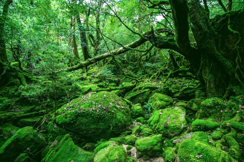
The green moss covering these ancient Japanese cedars and boulders is simply mesmerizing (as well as damp).
Photo by Wirestock Creators/Shutterstock
Yakushima
Kagoshima Prefecture, Kyushu
Situated 37 miles off the southernmost tip of Kyushu, the island of Yakushima is home to a UNESCO-protected forest dominated by thousand-year-old yakusugi (Japanese cedars). The most famous tree in the ancient forest is Jōmon Sugi; estimated to be between 2,000 and 7,200 years old, it stands at the end of the 13-mile round-trip Arakawa trek, which climbs more than 3,280 feet and takes about 10 hours to complete. Despite its rigor, the trail gets crowded during peak hiking season from July through September.
To get off the beaten path, follow the attractive Shiratani Unsuikyo trail, a four-hour route through an ethereal forest that passes dozens of astonishing yakusugi. In Yakusugi Land, a southeastern part of the forest, there are also four fairly easy hiking trails—from 30 minutes to 150 minutes long—that showcase electric-green moss and lively brooks and pass at least a half-dozen other ancient cedars.
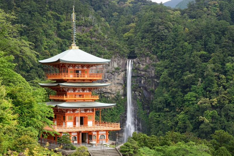
The Kumano Kodo’s Nakahechi circuit is nicknamed “The Imperial Route” because it was developed by nobles.
Photo by motive56/Shutterstock
Kii Peninsula
Wakayama Prefecture, Honshu
South of Osaka, this mountainous peninsula is home to the Kumano Kodo, a UNESCO-designated network of sacred pilgrimage routes offering access to sweeping views, Buddhist shrines, and traditional Japanese onsen. Nakahechi, the most sacred of the Kumano’s trails, was developed by emperors and nobles in the 10th century; it connects three grand shrines known collectively as the Kumano Sanzan. There are a couple of ways to take on the circuit, including a 72-mile trail that passes all three shrines, a 42-mile course that traverses the Kii Mountains, and shorter day hikes between the area’s many hot spring villages. Depending on which route you choose, the trip can take anywhere from two to six days to complete. Hikers typically stay in ryokan and minshuku (guesthouses) along the way.
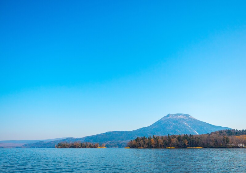
Peak hiking season in Akan-Mashu National Park occurs between June and October; in winter, the lake freezes over and skating is popular.
Photo by Ong.thanaong/Shutterstock
Akan-Mashu National Park
Hokkaidō Prefecture, Hokkaidō
One of Hokkaido’s oldest national parks, Akan-Mashu is known for its striking crater lakes and healing hot springs. The park’s namesake, Lake Akan, coughs up alien-looking, grapefruit-size balls of algae called marimo (which you can also view at the visitor center). Nearby, the colors of resplendent Lake Onneto appear to shift depending on the weather and time of day, moving between shades of emerald green and cerulean from one hour to the next. All routes in the park are rewarding, but if you can only hike one, choose Lake Mashu. A caldera lake, Mashu has no connecting waterways; it’s enclosed by a rocky 1,300-foot-tall rim and is one of the clearest lakes in the world, with underwater visibility of up to 136 feet. You can’t hike to the water’s edge, but the view from the observation deck is enchanting: On a sunny day, the glassy water reflects the sky and nearby mountains. The ascent takes about three hours each way and is moderately difficult until the last hour, when it becomes steep and slippery. It is not for novice hikers or inclement weather.
This article was originally published in 2018 and most recently updated on October 14, 2024, with current information.


